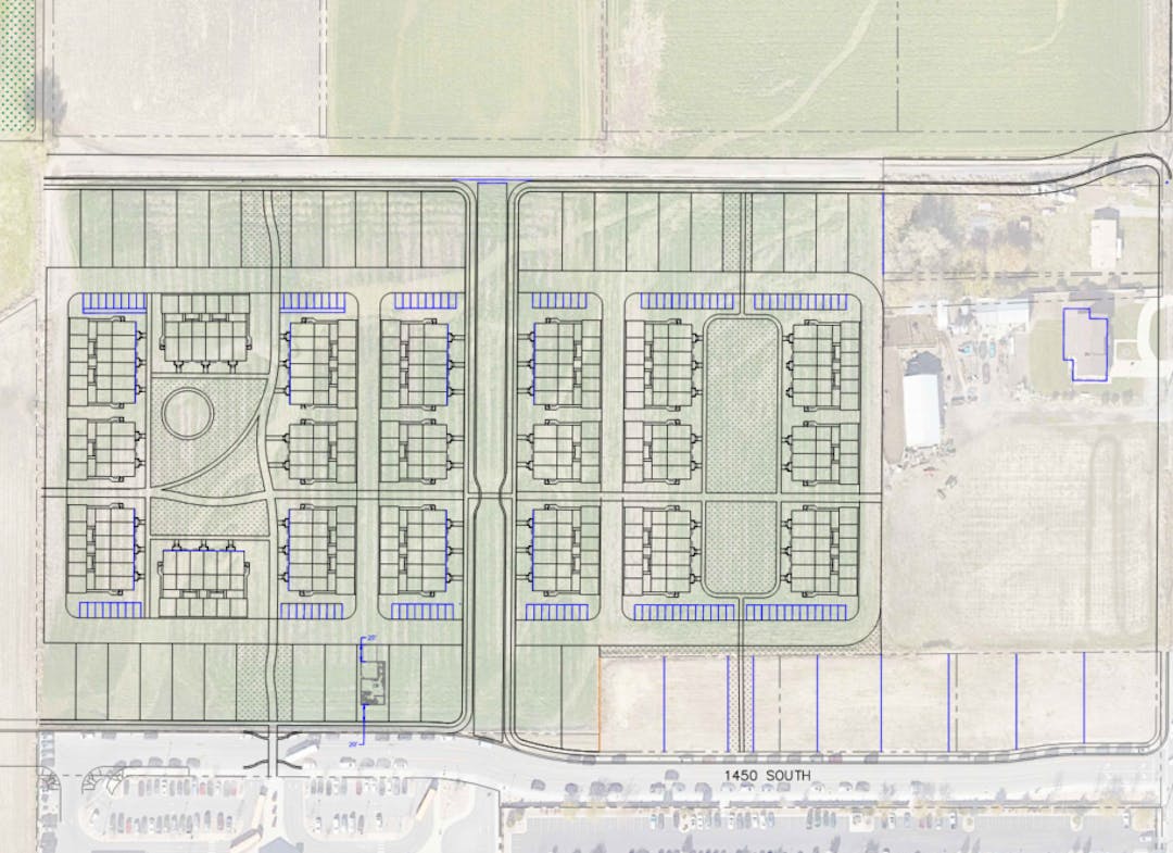
Dry Creek Village Concept
Consultation has concluded

The applicant requests approval of the Dry Creek Village Land Use Plan with Concept plan located at 1450 South 1100 West. The Concept Plan is for the first phase which includes a 150-unit residential development. The applicant proposes the conceptual subdivision to be similar to a Planned Unit Development. The Village Overlay designation, allows for a zone change to the Mixed-Use zone and the entire Village Overlay is planned for 500 units. As part of establishing the mixed-use zone, the overlay requires a land use map to show the general street layout, land uses, circulation, trails, open spaces, and list the features and amenities to be included in the development. To receive the allotted density, the design must meet criteria as envisioned by Planning Staff, Planning Commission, and the City Council.
The Planning Commission should consider the site layout, the building elevations, land use plan, and the DRC comments.
Site Layout
The first phase of the proposed development site is shown on 16 acres of property. The plan shows 108 townhome units and 42 single family units along private roads. There is also landscaped space with lawn and trees, connected by several bike and pedestrian paths. The primary amenity space is located along a path that leads directly to the front door of the elementary school. Amenities include a play space, shaded picnic tables, and fire pits. Traffic calming features are proposed to create a human-first environment that still allows localized car access. It was suggested by the DRC that the center public street be eliminated and instead have private street connection into the internal loop and adding open space to the center to reduce cut-through traffic and a more connected network of greenways.
Building Elevations
The conceptual elevations show several different variations in the façade. The final elevations will be reviewed with final submittal and will need to meet the building materials and features requirements.
Land Use Plan
The land use plan shows a mixed-use area, northern area, and southern area. The mixed-use area is 5.3 acres along Pioneer Crossing and 1100 West. The northern area is 33.6 acres and the southern area is 28.1 acres. The first phase comprises a section of the southern area. The mixed-use area is programmed for 40 units, the northern area for 250 units, and the southern area for 210 units. Trail corridors are shown throughout the land use plan and are shown connecting into the future park area to the west and to connect to the Dry Creek Trail and undercrossing to the north.
Ask a question to staff. You may submit a question here or call staff directly using the information provided on the right side bar.

